")
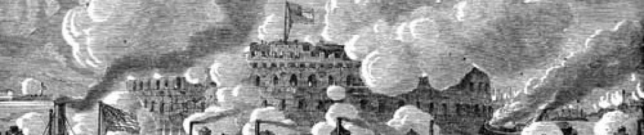
Bombing Hatteras at yet another Seat of War
From The New-York Times October 11, 1861:
Another “Bird’s-Eye View.”
The “seat of war” does not seem to be a standing one. It changes its location almost daily. But the publishers of maps follow it up faithfully. Thus, JOHN BACHMAN, who has before published several panoramic views of other marshes where the war fever prevails, now publishes a “Bird’s-Eye View,” of North and South Carolina and a part of Georgia. He has judiciously introduced a few ships in the vicinity of Hatteras Inlet, and represented the bombardment and capture of that fortification. Mr. BACHMAN’s maps are so arranged that they can be joined together — each representing a part of one gigantic whole — and he makes no extra charge for putting them through the pasting process.
John Bachmann, Sr. “was a Swiss-born lithographer and artist best known for his bird’s-eye views …” This work was “drawn from an imagined perspective” (no hot air balloons here). He enjoyed a long career:
")
pre-Secession work: Pelicans' eye view of New Orleans
")
Philadelphia preps for the Centennial Exposition
