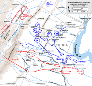
converging on the Rappahanock: ‘The camp fires of the enemy are constantly increasing within sight of Falmouth’:
From a Seneca County, New York newspaper in 1862:
From Gen. Burnside’s Army.
FALMOUTH, Va. Nov. 26.
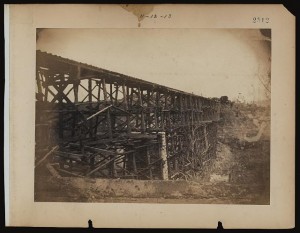
It is expected the railroad will be finished to-morrow from Acquia Creek to the Rappahannock, opposite Fredericksburg. The bridge over Potomac Creek was reported this morning as nearly completed. The cars carry supplies as far as Brook’s Station, six miles from Acquia Creek, which greatly accomodates our troops.
Notwithstanding the late bad condition of the roads, quartermasters supplies have been promptly furnished. Long lines of roads have been corduroyed, under direction of Colonel Ingalls, chief quartermaster of the army, and are in good condition.
The camp fires of the enemy are constantly increasing within sight of Falmouth, affording indications of the augmentation of the rebel forces. Lee has joined Longstreet and A.P. Hill. D.H. Hill and Jackson are known to be on the way thither.
Yesterday the enemy were busily engaged in constructing additional works in the rear and to the left of Fredericksburg.
The cars bring troops and supplies regularly to the rebel troops, stopping at a point three miles from the town.
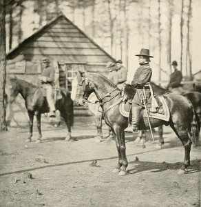
Rufus Ingalls was promoted to Chief Quartermaster of the Army of the Potomac in August, 1862. In 1864 he would be responsible for building up the federal supply depot at City Point.
The map by Hal jespersen is licensed by Creative Commons.


![Building corderoy [sic] roads from Belle Plain to Frederickburgh [sic] (H.Q.) (by Arthur Lumley, between 1860 and 1865; LOC: LC-DIG-ppmsca-20775) Building corderoy [sic] roads from Belle Plain to Frederickburgh [sic] (H.Q.) (by Arthur Lumley, between 1860 and 1865; LOC: LC-DIG-ppmsca-20775)](https://www.bluegrayreview.com/wp-content/uploads/2012/11/20775r-300x223.jpg)
